Construction
Keep every site capture connected to the project.
Reality-capture on an active site produces maps, models, stills, and clips that lose value when they live as unrelated uploads. SpearAtlas keeps those visits together so owners, supers, and consultants can review the same project over time.
No credit card required · Free plan includes 5 GB
The delivery problem
Each site visit should not become a new folder.
Weekly or monthly capture is common on construction: an updated ortho, a mesh of the current envelope, a photo set of issues, a walkthrough clip, and a PDF snapshot for the owner. Those packages often go out as separate Drive folders or email attachments, so later visits do not sit next to earlier ones.
Stakeholders then reconstruct the timeline themselves—or they never do. The spatial context that made the capture worth doing never quite reaches the people who need to see the site.
SpearAtlas is not a construction-management platform. It does not replace Procore, Autodesk Construction Cloud, or scheduling tools. It is the reality-capture delivery layer: the place the maps, models, and media from those visits remain organized around the job.
- Progress media detached from the project they describe
- Owners opening files without site context
- Repeat captures that never form a readable sequence
- Maps, models, and reports traveling on different links
How SpearAtlas fits
A project workspace around the captures
Upload each visit into the same SpearAtlas project. Orthos go to Maps, meshes and optional point clouds to Space, stills and video to their rooms, and PDFs to reports or supporting files.
When you share the project, the owner or consultant reviews current conditions in the browser and can still see the rest of the package—without you assembling a new zip for every meeting.
Capture / process
Your drone, scanner, photogrammetry, or reconstruction software produces the files. SpearAtlas is not in this step.
Step 1 of 4Organize in SpearAtlas
Upload the outputs into Mission Hub rooms so maps, models, media, and documents sit on the same project.
Step 2 of 4Deliver
Preview the client experience, then share one project link instead of a chain of folders.
Step 3 of 4Client views
Recipients review supported files in the browser, with the project context still attached.
Step 4 of 4
Relevant deliverables
Formats this workflow typically brings in
Construction documentation often mixes geospatial outputs with everyday site media. These are the formats SpearAtlas currently hosts for that mix.
- GeoTIFF / TIFFOrthomosaic map rooms for hosted GeoTIFF review.
- LAS / LAZOptional aligned point-cloud layers in Space.
- OBJPhotogrammetry meshes in the 3D Space room.
- GLB / GLTFTextured 3D models for site and structure review.
- JPEG / PNG / WebPInspection photos, progress stills, and supporting imagery.
- MP4Hosted project and progress video in a dedicated room.
- PDFReports and plan PDFs delivered with the same project.
- CSVTables and field notes kept with supporting files.
- DOC / DOCXWritten reports and scope notes in supporting files.
- XLS / XLSXSpreadsheets attached to the same mission workspace.
In the workspace
Capabilities that apply here
The job stays the container
Treat the construction project as the workspace. Each capture adds rooms or updates files without starting a new dump of links.
The job stays the container in SpearAtlas →Site maps for progress review
Host the current orthomosaic so the team can read layout and earthwork in the browser, then switch to photos or the model for the same visit.
Site maps for progress review in SpearAtlas →3D context for the envelope
Deliver the current mesh when the capture includes one, so massing and existing conditions are not trapped in a desktop viewer.
3D context for the envelope in SpearAtlas →Progress photos and clips
Keep stills and MP4 walkthroughs with the maps they belong to, instead of a separate photo album the owner has to hunt down.
Progress photos and clips in SpearAtlas →Reports next to the visuals
Attach meeting PDFs, narratives, and field summaries to the same project the spatial files live in.
Reports next to the visuals in SpearAtlas →Handoff to owners and trades
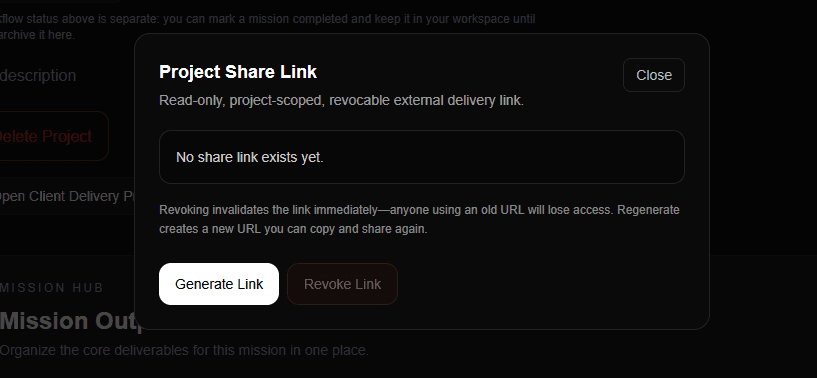
Share a read-only project link. Recipients review; they do not need edit access to the working files.
Handoff to owners and trades in SpearAtlas →
A typical project
A typical progress cycle
A mid-rise job with monthly drone mapping plus a handheld photo pass of interiors. The GC needs the owner and the civil consultant to see the same package after each visit.
Capture the visit
Fly or walk the site. Process the ortho and mesh in your usual tools. Pull a still set and a short clip of the current conditions.
Update the SpearAtlas project
Open the existing job—not a new share folder. Replace or add the ortho, Space model, images, video, and PDF for this visit.
Keep titles consistent
Name rooms so later visits are obvious: May ortho, May envelope model, May photo pass. The project carries the history.
Send the same project link
The owner already has the link. They open current maps and media without collecting a new set of URLs from email.
Continue
Related workflows and product pages
- Land DevelopmentShow site context with the files.
- InspectionsGive findings spatial context.
- Drone OperatorsDeliver complete mapping projects.
- Orthomosaic deliverySpearAtlas product
- Image roomsSpearAtlas product
- Storage and project limitsSpearAtlas product
Back to SpearAtlas homeView pricing
Related guides
- How to Review a Point Cloud Before Delivering It to a ClientA practical workflow for reviewing an exported LAS or LAZ point cloud before client delivery, including orientation, attributes, coordinates, a distance check, and keeping the original file.
- GCPs vs Checkpoints in Drone Mapping: What Is the Difference?Learn the difference between ground control points and checkpoints in drone mapping, including how they affect photogrammetry accuracy, RTK workflows, control distribution, residuals, and independent verification.
- Coordinate Systems in Drone Mapping: CRS, Datums, EPSG Codes, and Elevation ExplainedLearn how coordinate systems work in drone mapping, including CRS, datums, projections, EPSG codes, State Plane, UTM, latitude and longitude, vertical datums, and why mapping files sometimes fail to align.
Get started
Give the next site visit a permanent home.
Put construction captures in one SpearAtlas project so maps, models, and progress media stay attached to the job.