Land development
Give land projects a clearer view of the site.
Land and development work needs spatial context beside the usual PDFs and spreadsheets. SpearAtlas hosts orthomosaics, models, point clouds, imagery, video, and documents in one project for developers, owners, contractors, and consultants. It is not a GIS, CAD, or entitlement platform.
No credit card required · Free plan includes 5 GB
The delivery problem
Stakeholders need to see the land, not hunt the files.
A development package might include a site ortho, a mesh or cloud of existing conditions, a drone clip of access and drainage, stills of constraints, and a stack of PDFs. Those usually travel as a Drive folder the landowner never fully opens.
Meetings then spend their first twenty minutes establishing what people are looking at. The spatial files that would have oriented the room stay unopened because they are awkward to share.
SpearAtlas does not run GIS analysis, draft CAD, or manage entitlements. It delivers the site visuals and supporting files so everyone in the conversation can see the same ground.
- Orthos and models that never reach the landowner
- PDFs discussed without the site view they describe
- Consultants working from a different file set than the owner
- Video and stills stored apart from the mapping outputs
How SpearAtlas fits
Site context beside the project papers
Host the GeoTIFF in Maps, the mesh and optional LAS/LAZ in Space, stills and MP4 in media rooms, and PDFs plus spreadsheets in reports and supporting files. Share one project with the developer, owner, contractor, and consultant.
They review the site in the browser. Design, platting, and approvals remain in the professional tools responsible for those tasks.
Capture / process
Your drone, scanner, photogrammetry, or reconstruction software produces the files. SpearAtlas is not in this step.
Step 1 of 4Organize in SpearAtlas
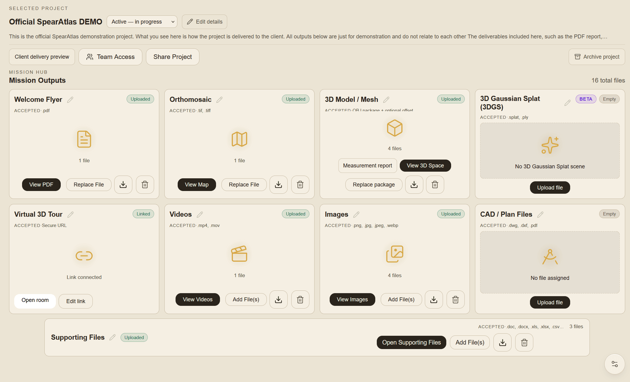
Upload the outputs into Mission Hub rooms so maps, models, media, and documents sit on the same project.
Step 2 of 4Deliver
Preview the client experience, then share one project link instead of a chain of folders.
Step 3 of 4Client views
Recipients review supported files in the browser, with the project context still attached.
Step 4 of 4
Relevant deliverables
Formats this workflow typically brings in
Land projects typically mix mapping outputs with conventional documents. These are the formats SpearAtlas can hold for that mix.
- GeoTIFF / TIFFOrthomosaic map rooms for hosted GeoTIFF review.
- LAS / LAZOptional aligned point-cloud layers in Space.
- OBJPhotogrammetry meshes in the 3D Space room.
- GLB / GLTFTextured 3D models for site and structure review.
- PLYPoint-cloud layers, or Gaussian splat PLY in the 3DGS room.
- JPEG / PNG / WebPInspection photos, progress stills, and supporting imagery.
- MP4Hosted project and progress video in a dedicated room.
- PDFReports and plan PDFs delivered with the same project.
- CSVTables and field notes kept with supporting files.
- DOC / DOCXWritten reports and scope notes in supporting files.
- XLS / XLSXSpreadsheets attached to the same mission workspace.
In the workspace
Capabilities that apply here
A shared view of the parcel
Host the site ortho so owners and consultants can orient themselves before they open the PDFs.
A shared view of the parcel in SpearAtlas →Existing-conditions models
Deliver a mesh or optional point cloud when the capture includes one, for terrain and structure context in the browser.
Existing-conditions models in SpearAtlas →Stills and site video
Keep access-road clips, constraint photos, and walkthroughs with the mapping outputs they illustrate.
Stills and site video in SpearAtlas →Reports and supporting documents
Attach PDFs, DOCX narratives, and XLSX or CSV tables to the same project as the site visuals.
Reports and supporting documents in SpearAtlas →One project for the parcel
Treat the land job as the container. Later captures and memos update the same workspace.
One project for the parcel in SpearAtlas →Stakeholder review without extra software
Developers, landowners, contractors, and consultants open the same read-only project link.
Stakeholder review without extra software in SpearAtlas →
A typical project
A typical land-project delivery
A due-diligence capture for a 60-acre parcel. You have a GeoTIFF, a LAS cloud, an OBJ of the existing barn cluster, a two-minute access video, and a PDF of field notes for the developer and the landowner.
Map and process
Complete the flight and processing in your mapping tools. Entitlements, CAD, and GIS analysis stay outside SpearAtlas.
Assemble the site project
Upload the ortho, cloud, mesh, video, stills, and PDF into one SpearAtlas job named for the parcel.
Check the stakeholder path
Preview as a landowner: map first, then model, then notes. Rename rooms if the file names are opaque.
Share with the circle
Send one link to the developer, owner, and civil consultant. They look at the same site record ahead of the next call.
Continue
Related workflows and product pages
- ConstructionKeep site documentation together.
- Surveying & MappingHand off orthos and models clearly.
- Reality CaptureShare models, splats, and point clouds.
- Orthomosaic deliverySpearAtlas product
- 3D SpaceSpearAtlas product
- Supporting filesSpearAtlas product
Back to SpearAtlas homeView pricing
Related guides
- GeoTIFF vs Cloud Optimized GeoTIFF: What Is the Difference?Learn the difference between GeoTIFF and Cloud Optimized GeoTIFF files, including georeferencing, tiling, overviews, HTTP range requests, browser viewing, cloud storage, and drone mapping workflows.
- Drone Mapping Deliverables Explained: GeoTIFF, LAS, LAZ, 3D Models, DSMs, and MoreA practical guide to the files produced by drone mapping and photogrammetry, including orthomosaics, GeoTIFFs, point clouds, LAS and LAZ files, elevation models, 3D meshes, reports, and supporting project data.
- Construction progress documentation: what it is and how to build a better site recordWhat construction progress documentation is, the records teams actually keep, and how to set up a repeatable jobsite documentation workflow that people can still use months later.
Get started
Let the next parcel open as a project, not a folder.
Put site maps, models, media, and documents in one SpearAtlas workspace for everyone who needs to see the land.