Surveying & mapping
A cleaner way to deliver mapping outputs.
Orthomosaics, point clouds, and site models are the job. Getting a landowner, engineer, or contractor into those files is the friction. SpearAtlas is the workspace and viewer layer after your survey or mapping software has done the work.
No credit card required · Free plan includes 5 GB
The delivery problem
Specialist files should not require specialist software on the client side.
A mapping delivery might include a GeoTIFF, a classified or dense LAS/LAZ, a mesh, and a PDF of notes or control. Those files are correct in your tools. They are awkward in email. Recipients download a TIF, see a black rectangle in Photos, and write back asking how to open it.
You then walk them through QGIS, a point-cloud viewer, or a 3D application they will not keep installed. The quality of the survey work is not the problem. The handoff is.
SpearAtlas does not produce legally certified survey plats, does not establish accuracy, and does not replace your CAD, GIS, or adjustment software. It hosts the mapping outputs you export so project stakeholders can view them in context.
- GeoTIFFs that fail in consumer photo apps
- Point clouds that never leave the operator’s workstation
- Models, maps, and notes sent as unrelated attachments
- No shared place to talk about the same site
How SpearAtlas fits
Viewing and delivery after the mapping software
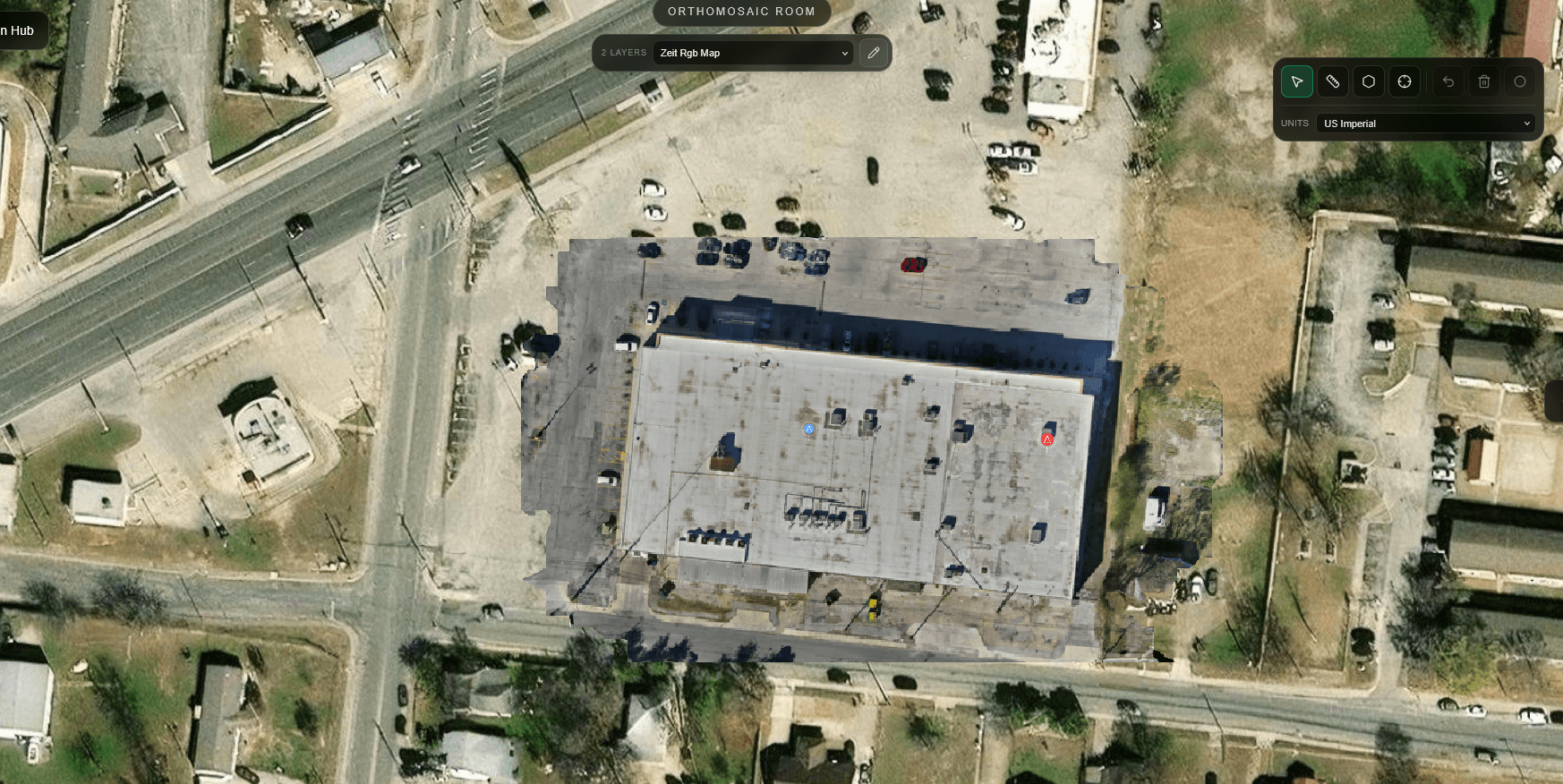
Export from the tools you already use. Upload the ortho to Maps, the mesh to Space, and LAS/LAZ or PLY as aligned point-cloud layers when the job includes them. Put the narrative PDF and CSV sheets in supporting files.
Share the project. Reviewers pan the map, inspect the model, and read the notes without installing your stack. You remain the surveyor or mapping professional; SpearAtlas is the delivery surface.
Capture / process
Your drone, scanner, photogrammetry, or reconstruction software produces the files. SpearAtlas is not in this step.
Step 1 of 4Organize in SpearAtlas
Upload the outputs into Mission Hub rooms so maps, models, media, and documents sit on the same project.
Step 2 of 4Deliver
Preview the client experience, then share one project link instead of a chain of folders.
Step 3 of 4Client views
Recipients review supported files in the browser, with the project context still attached.
Step 4 of 4
Relevant deliverables
Formats this workflow typically brings in
Advertise only what the workspace can host today. These mapping-related formats are accepted in Mission Hub rooms.
- GeoTIFF / TIFFOrthomosaic map rooms for hosted GeoTIFF review.
- LAS / LAZOptional aligned point-cloud layers in Space.
- OBJPhotogrammetry meshes in the 3D Space room.
- GLB / GLTFTextured 3D models for site and structure review.
- PLYPoint-cloud layers, or Gaussian splat PLY in the 3DGS room.
- PDFReports and plan PDFs delivered with the same project.
- CSVTables and field notes kept with supporting files.
- DOC / DOCXWritten reports and scope notes in supporting files.
- XLS / XLSXSpreadsheets attached to the same mission workspace.
- JPEG / PNG / WebPInspection photos, progress stills, and supporting imagery.
In the workspace
Capabilities that apply here
Hosted GeoTIFF review
Clients zoom from site-wide context toward detail on a georeferenced ortho, with distance, area, and coordinates when the map supports them.
Hosted GeoTIFF review in SpearAtlas →Point clouds in Space
Optional LAS, LAZ, or PLY layers alongside the mesh so dense geometry is not a separate desktop-only artifact.
Point clouds in Space in SpearAtlas →Site models in the browser
OBJ, GLB, and GLTF meshes for existing-conditions review, with 3D measurements when you need lengths, areas, heights, slopes, or volumes on the model.
Site models in the browser in SpearAtlas →Numbers attached to the deliverable
Measure on supported maps and meshes inside the project. These are review measurements in SpearAtlas, not a substitute for survey certification.
Numbers attached to the deliverable in SpearAtlas →Notes and sheets with the geometry
Keep control notes, narratives, and tabular CSVs beside the spatial files they describe.
Notes and sheets with the geometry in SpearAtlas →Stakeholder access without your workstation
One project link for the engineer, owner, or contractor who needs to see the mapping outputs, not edit the production files.
Stakeholder access without your workstation in SpearAtlas →
A typical project
A typical mapping handoff
A topographic mapping job for a civil firm. You have a GeoTIFF ortho, a LAS cloud, an OBJ mesh, and a PDF of methods. The engineer needs to look at the site before the next design meeting.
Finish the mapping work
Complete control, processing, and exports in your survey or photogrammetry software. Accuracy and certification stay there.
Load the exports
Upload the GeoTIFF, mesh, and cloud into one SpearAtlas project. Add the methods PDF and any CSV of points you want the client to see.
Check the rooms
Confirm the ortho georeference behaves, the model orients correctly, and titles match how you will describe the delivery on the call.
Share for the meeting
Send the project link ahead of the review. The engineer opens the map and model in the browser instead of requesting another zip.
Continue
Related workflows and product pages
- Drone OperatorsDeliver complete mapping projects.
- Land DevelopmentShow site context with the files.
- Reality CaptureShare models, splats, and point clouds.
- Orthomosaic roomsSpearAtlas product
- 3D Space and point cloudsSpearAtlas product
- View pricingSpearAtlas product
Back to SpearAtlas homeView pricing
Related guides
- How to Review a Point Cloud Before Delivering It to a ClientA practical workflow for reviewing an exported LAS or LAZ point cloud before client delivery, including orientation, attributes, coordinates, a distance check, and keeping the original file.
- Point Cloud vs 3D Mesh vs Gaussian Splat: Which 3D Deliverable Should You Use?Compare point clouds, 3D meshes, and Gaussian splats for drone mapping and reality capture, including measurement, visualization, file formats, accuracy, client delivery, and when to use each.
- GCPs vs Checkpoints in Drone Mapping: What Is the Difference?Learn the difference between ground control points and checkpoints in drone mapping, including how they affect photogrammetry accuracy, RTK workflows, control distribution, residuals, and independent verification.
Get started
Let the next mapping package open in the browser.
Keep orthomosaics, clouds, and models in one SpearAtlas project so stakeholders can review the site without your desktop tools.