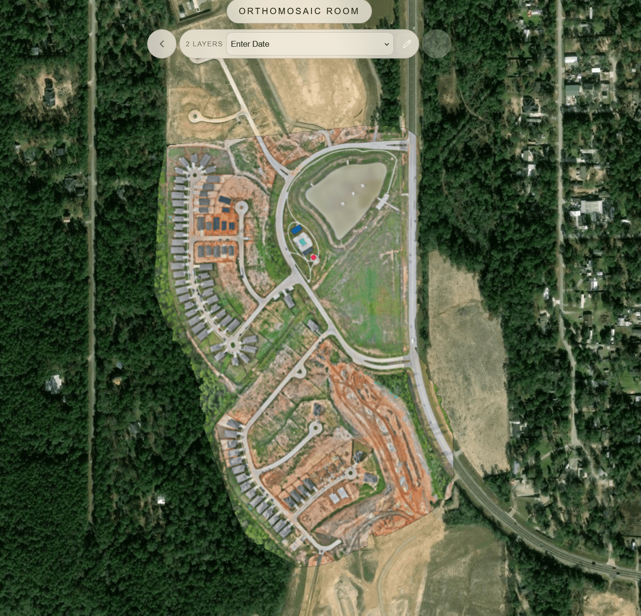
An orthomosaic is a map made from photographs. Individual aerial frames are stitched, geometrically corrected, and placed in a real-world coordinate system so distances and areas can be measured. It looks like a photograph. It behaves like a map.
That distinction matters. A pretty aerial is not an ortho. A screenshot from Google is not your survey product. An orthomosaic is a controlled image of this site, at this time, in a known CRS.
How an ortho is made
The usual drone-mapping path:
- Fly a grid (or corridor) with enough overlap.
- Recover camera positions, often with GNSS/RTK or ground control.
- Build a dense reconstruction and a digital surface or terrain model.
- Orthorectify the imagery so relief and tilt are removed as far as the model allows.
- Mosaic the corrected frames into one raster, typically a GeoTIFF.
Accuracy depends on the control network, GSD, processing settings, and how well the surface model represents the ground. An ortho of a flat pad is a different problem from an ortho of a pit or a dense canopy. Drone photogrammetry accuracy explained covers those factors without treating a sharp mosaic as automatically survey-grade.
Orthomosaic vs. aerial photo vs. basemap
| Product | Georeferenced | Measurable | Represents your flight |
|---|---|---|---|
| Handheld or drone still | Usually not | No | Yes, locally |
| Consumer map imagery | Yes, coarsely | Not for your job | No |
| Orthomosaic | Yes, by design | Yes, within project accuracy | Yes |
Clients sometimes treat all three as “the aerial.” If the deliverable is supposed to support quantities, overlays, or as-built context, only the ortho is doing that job. Construction teams that fly the same site on a schedule use that map as a dated progress layer; drone mapping for construction covers how those repeats are planned and compared.
Files you will actually export
Most photogrammetry tools write a GeoTIFF. For web delivery, a Cloud Optimized GeoTIFF (COG) is the practical upgrade: the same raster, structured so a browser can request the tiles it needs instead of downloading the whole file. GeoTIFF vs Cloud Optimized GeoTIFF explains that difference without treating COG as a different map.
You may also export:
- A world file plus JPEG/TIFF for simpler GIS packages
- Tilesets for web maps
- A PDF sheet for people who need a plotted view
The GeoTIFF is the source of truth. The PDF is a view. Do not let the view replace the dataset. For the rest of a typical mapping package, including point clouds, elevation models, and 3D meshes, see drone mapping deliverables explained.
How to share an ortho with a client
Sending a 2 GB TIF as an email attachment is not a delivery. Most clients cannot open it, and those who can will not thank you for the wait.
A client-ready ortho is:
- Openable in a browser, at the project CRS
- Paired with the report, photos, and any 3D that belong to the same job
- Labeled so it is obvious which capture it is
That is a mapping deliverable. A file in a folder is only the export. How to share mapping deliverables with a client covers keeping the ortho with the rest of the job instead of sending it as an orphaned TIF. Drone operators and surveying teams run into this as soon as processing is finished.